 Revolutionizing · Modernizing · Simplifying
Dozens of people showed up on a Sunday night to say goodbye to a gravel path.
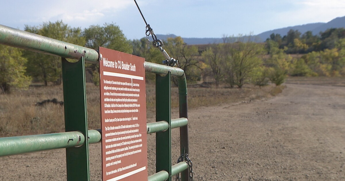
That tells you something. This was not some remote trailhead you drive forty minutes to reach. This was the flat two-mile loop near Table Mesa and Frasier Meadows that half of South Boulder treated like an extension of their own block. Stroller-friendly. Wide enough for bikes and dogs. The kind of walk you do without thinking about it, in slippers, with a coffee, before work.
And as of the week of Oct. 5, 2026, it is gone. Fenced off. Possibly until 2031.
So right behind that fence, at Highway 36 and Table Mesa Drive, the City of Boulder just started the South Boulder Creek Flood Mitigation Project across the entire 308-acre CU South site. Construction is projected to run three to five years. Do the math on the back end of that and you land in 2031 before anyone is walking that loop again.
Here is the thing. This is not a trail closure for fun. This is a payoff that has been coming for thirteen years.
September 2013. South Boulder Creek overtopped US 36 and sent waist-deep water into the Frasier Meadows Retirement Community and the neighborhoods around it. Think about that for a second. Waist-deep water, a retirement community. That is the whole reason any of this exists.
The project is built to make sure that never happens again. When it is done, it is designed to protect an estimated 2,300 residents and 260 structures and to keep the creek from topping Highway 36 during a flood. The build itself is serious infrastructure. An earthen detention dam along the north and west edges of the site. A concrete floodwall and spillway running along US 36, standing somewhere between 6 and 18 feet tall depending on where you are. An outlet tunnel under the highway. A groundwater management system on top of all that.
Concrete Express, Incorporated, or CEI, was picked in fall 2025 to lead the work. Price tag is $76.5 million, funded out of City Council-appropriated stormwater revenues in partnership with the Mile High Flood District.
And this is the part people miss. Five years is not just how long it takes to pour that much concrete.
The city says litigation prevents it from bonding for the work. So instead of borrowing the full amount up front and building straight through, Boulder is paying for this year to year, on a cash basis. Pay-as-you-go. That stretches the schedule and, honestly, raises the total cost. You are funding a $76.5 million project with whatever cash is on hand each budget cycle. That is why the loop sits closed longer and why your tax dollars buy less.
Now, how does the city even get to do this on CU land. Good question.
CU Boulder has owned this 308-acre property since 1996. The thing that unlocked everything was the CU South annexation agreement, approved by Boulder City Council in 2021. That brought the site into city limits and set up the university's transfer of roughly 155 acres to the city. Of that, 119 acres become new permanently protected open space. So the trade, long term, is flood protection plus a big chunk of guaranteed open space.
Part of the plan also calls for removing a warehouse and the tennis courts out there and reestablishing South Loop Drive. So the finished site is going to look different than the one people walked last week.
Here is where it gets real for homeowners, and I mean real dollars.
The city estimates roughly 260 properties could eventually come off the mapped 100-year floodplain once this is finished. If your house gets pulled out of that floodplain, your required flood insurance can drop or go away entirely. That is not a small line item. For a lot of those households near Frasier Meadows and Table Mesa, that is hundreds or even thousands of dollars a year back in their pocket, plus a cleaner story when they go to sell. A home that no longer carries a mandatory flood insurance requirement is simply an easier sell. That is just how buyers read it.
So the long game actually helps property values in that pocket of South Boulder. It is the next five years that hurt.
Not everybody is thrilled, and I get it.
That Sunday night gathering before the closure was residents sharing memories of the land, people like Renee St. Aubin. And resident Marki LeCompte told Denver7 she objects to the dam specifically. Worth being precise here. She said she is not against flood mitigation itself. She is against this version of it, the dam. Those are two different things, and the difference matters when you are the one looking at a 6-to-18-foot concrete wall along the highway you drive every day.
So where do the dog walkers and stroller crowd go for the next five years. Honestly, South Boulder has options. Other flat trails, other open space, it is Boulder. But none of them are the one that was basically in your backyard. That is the part you cannot replace on a Tuesday morning.
Five years is a long time to lose your easy walk. The 2013 flood is the reason you are losing it. And in 2031, the people who stuck around get a safer neighborhood, a cheaper insurance bill, and 119 acres of open space that is not going anywhere. That is the trade.